Impact of Geospatial Data Applications in India: A Comprehensive Overview
- kassarenterprise
- Feb 2
- 4 min read

Geospatial data has become a critical resource in India’s infrastructure and development sectors. Its applications influence planning, execution, and management of projects across various domains. The integration of geospatial technology enhances decision-making by providing accurate spatial information. This article explores the impact of geospatial data applications in India, focusing on practical examples and actionable insights for infrastructure developers, government agencies, and construction companies.
Understanding the Geospatial Data Impact on Infrastructure Development
The impact of geospatial data on infrastructure development in India is significant. It enables precise mapping, monitoring, and management of land and resources. This technology supports the design and construction of roads, bridges, railways, and urban infrastructure by providing detailed spatial analysis.
For example, geospatial data helps identify optimal routes for highways, reducing construction costs and environmental impact. It also assists in assessing land suitability for construction, avoiding areas prone to flooding or geological hazards. This reduces risks and improves project sustainability.
In urban planning, geospatial data supports smart city initiatives by mapping utilities, traffic patterns, and population density. This information guides infrastructure upgrades and resource allocation, improving service delivery and urban resilience.

Key Benefits of Geospatial Data Applications in India
Geospatial data applications offer several benefits that directly affect project outcomes:
Improved Accuracy: Spatial data provides precise location information, reducing errors in design and construction.
Cost Efficiency: Early identification of challenges and optimal resource allocation lowers overall project costs.
Risk Management: Geospatial analysis helps detect environmental and geological risks, enabling proactive mitigation.
Enhanced Monitoring: Real-time data collection supports ongoing project monitoring and maintenance.
Better Decision-Making: Visualizing spatial relationships aids stakeholders in making informed choices.
These benefits contribute to faster project completion, higher quality infrastructure, and better compliance with regulatory standards.
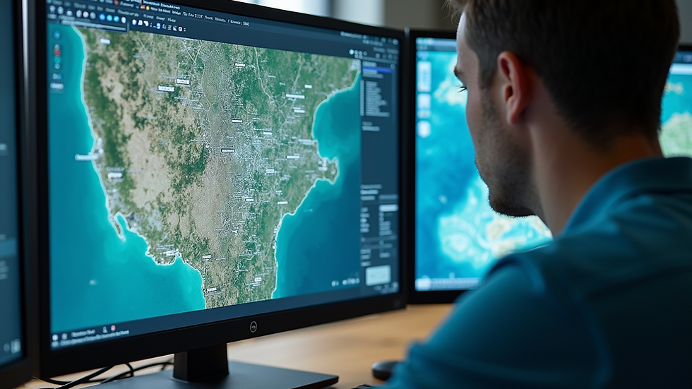
What is Geospatial Technology in India?
Geospatial technology in India refers to the tools and techniques used to collect, analyze, and visualize geographic information. This includes Geographic Information Systems (GIS), Global Positioning Systems (GPS), remote sensing, and spatial data analytics.
India has invested heavily in geospatial infrastructure, with agencies like the Survey of India and ISRO leading efforts to develop accurate spatial databases. These technologies are applied in sectors such as agriculture, disaster management, urban planning, and transportation.
For instance, remote sensing satellites provide high-resolution images that help monitor land use changes and natural resources. GIS platforms integrate various data layers to support infrastructure planning and environmental assessments.
The government’s push for digital India and smart cities has accelerated the adoption of geospatial technology, making it a cornerstone of modern development projects.
Practical Applications of Geospatial Data in Indian Infrastructure Projects
Several practical applications demonstrate the value of geospatial data in India’s infrastructure sector:
Road and Highway Planning
Geospatial data helps design efficient road networks by analyzing terrain, traffic flow, and environmental constraints. This reduces construction time and improves connectivity.
Urban Development and Smart Cities
Mapping utilities, land parcels, and population density supports urban planners in optimizing land use and infrastructure services.
Disaster Management and Risk Assessment
Geospatial tools identify flood-prone areas, earthquake zones, and other hazards, enabling better preparedness and response strategies.
Water Resource Management
Spatial data assists in watershed management, irrigation planning, and monitoring water quality, ensuring sustainable resource use.
Railway and Metro Projects
Accurate spatial data supports route alignment, station placement, and construction monitoring, enhancing project efficiency.
These applications highlight how geospatial data integrates with civil engineering and project management to deliver better outcomes.
Recommendations for Leveraging Geospatial Data in Projects
To maximize the benefits of geospatial data applications in India, infrastructure developers and agencies should consider the following recommendations:
Invest in Training and Capacity Building
Equip teams with skills in GIS, remote sensing, and spatial analysis to effectively use geospatial tools.
Integrate Geospatial Data Early in Project Planning
Incorporate spatial analysis from the initial stages to identify risks and optimize designs.
Collaborate with Geospatial Experts
Partner with specialized consultancies to access advanced technologies and expertise.
Adopt Real-Time Data Monitoring
Use drones, IoT sensors, and satellite data for continuous project monitoring and timely interventions.
Ensure Data Accuracy and Standardization
Maintain high-quality spatial data and follow standards to facilitate interoperability and reliable analysis.
By following these steps, projects can achieve higher efficiency, reduced costs, and improved sustainability.
Future Trends in Geospatial Data Applications in India
The future of geospatial data applications in India looks promising with emerging technologies and increasing government support. Some trends to watch include:
Integration of Artificial Intelligence and Machine Learning
AI-powered spatial analysis will enhance predictive modeling and automate data interpretation.
Expansion of 3D and 4D Geospatial Modeling
Advanced visualization techniques will improve project design and stakeholder communication.
Increased Use of Unmanned Aerial Vehicles (UAVs)
Drones will provide high-resolution data for surveying and monitoring inaccessible areas.
Enhanced Public Access to Geospatial Data
Open data initiatives will promote transparency and innovation in infrastructure development.
Greater Emphasis on Sustainable Development
Geospatial tools will support environmental impact assessments and green infrastructure planning.
These developments will further strengthen the role of geospatial data in India’s infrastructure landscape.
Embracing Geospatial Data for Successful Infrastructure Projects
The impact of geospatial data applications in India is evident across multiple sectors. By leveraging accurate spatial information, infrastructure developers and government agencies can improve project planning, execution, and management. The use of geospatial technology reduces risks, lowers costs, and enhances the quality of infrastructure.
For organizations like KASSAR ENTERPRISES, integrating geospatial data into consultancy services offers a competitive advantage. Providing detailed project reports, advanced surveying, and spatial analysis helps clients make informed decisions and achieve successful project outcomes.
To stay ahead, it is essential to adopt the latest geospatial tools, invest in skilled personnel, and foster collaboration with technology providers. This approach will ensure infrastructure projects in India are efficient, sustainable, and aligned with national development goals.
For more detailed insights on geospatial data applications india, exploring specialized consultancy services can provide tailored solutions for your projects.


Comments